By Ian Smith
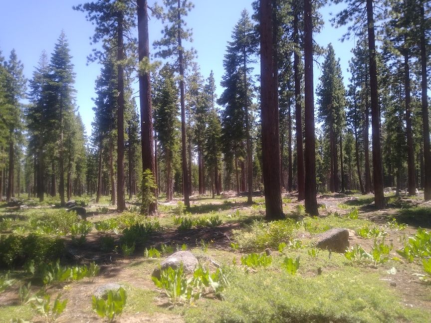
Burton Creek State Park is an alpine paradise characterized by white coniferous woods, excellent runnability, and open meadows. Situated at just over 2,000 m in elevation (6600 feet), the air pressure is roughly 80% that of sea level. Burton Creek is a montane forest with loosely-spaced pine trees and minimal scrub. Footing is excellent, and moderate leg protection like socks is recommended for the occasional shrub.
There are photos at the bottom of the page that show some of the features mentioned below.
Safety
The safety direction is southeast.
There will be water on the Orange through Blue courses. Because of the risk of dehydration at this altitude (particularly if it's a hot day), you might consider carrying water.
Please note that the water provided on the courses is for only a cup of water, not for refilling your own water container.
Also because of the altitude, there will be increased risk of sunburn, so be sure to use plenty of quality sunscreen.
The Map
The map scale is 1:7500 for the White, Yellow, and Brown courses. The scale is 1:10,000 for all the other courses.
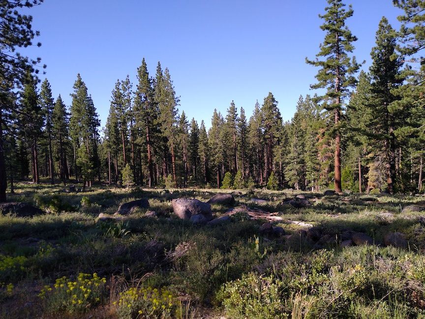
In contrast with the elevation, the contour features at Burton Creek are subtle, with only about 75 m between the highest and lowest points on the map. The contours are 5 m with 2.5 m form lines. The forest is predominantly white woods interspersed with rough-open meadows. While the mapping is faithful to the interfaces between the meadows and the white woods, it can be difficult to interpret these boundaries at speed. Prominent trees in the meadows are mapped individually with standard green ×s and Os.
There is a substantial trail network, with a mix of broad trails and twisting single-track. The smaller trails, in particular, can be easy to cross without noticing, especially in meadows. The map has some rides (dashed black line) that are basically just regions of lower tree density, and can be difficult to discern from the sparse forest.
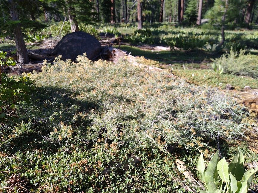
Small sections of green slash are typically patches of mountain whitethorn, an unpleasantly spiky bush under a meter tall. However, it's usually possible to find runnable paths through the slash without much difficulty.
Rock features are reliable, though some mapped isolated boulders are quite small. The largest boulders are up to 4 m in size.
There are a number of streams or water courses on the map that are dry and subtle.
There is ongoing construction immediately adjacent to the parking area for a cross country ski lodge. This is marked as out-of-bounds with purple slash on the map, and is not a plausible route choice on any course.
The park continues outside the mapped area, so take care not to run off the map.
Unmapped Features
There are several patches of burn piles — trees that have been felled and assembled into individual piles of logs, like a wooden knoll. These patches typically consist of several dozen piles, and the piles are roughly 1 m tall. They are not mapped, and the patches do not change the vegetation type (i.e., white woods are still white woods). They are not individually useful for navigation. There are no controls on the burn piles, and running through the patches is not impeded.
Courses
Here are the course details:
    Course    Length    Climb  Controls  Navigation
    White     2.0 km     45 m     12     Beginner
    Yellow    2.6 km     60 m     12     Adv. Beginner
    Orange    3.6 km     70 m     12     Intermediate
    Brown     3.7 km     65 m     12     Advanced
    Green     5.4 km     80 m     12     Advanced
    Red       7.7 km    160 m     20     Advanced
    Blue      8.8 km    160 m     22     Advanced
Beginners should be aware that the distances shown are the cumulative straight-line distances between controls. The climb numbers represent the amount of ascending that would be done on the "optimum route" (in the Course Setters' opinion), without regard for any descending. Because you won't travel in straight lines, and might not follow the optimum routes, your actual distance and climb will be somewhat more than what is shown above, and will depend on your route choices (and any errors you make). The walk from the Assembly Area (parking) to the Start is 800 m. (There is shade at the Start.)
The walk from the Finish to the Assembly Area is 150 m.
Photos
Burn Pile
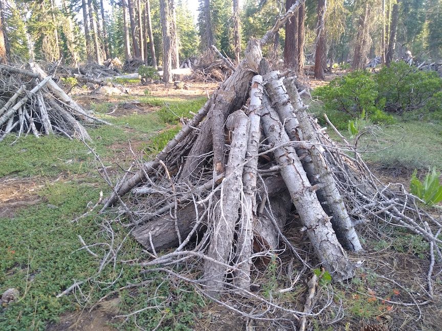
Another Burn Pile

Meadow
Edge of Meadow
Mountain Whitehorn